Sottevast | |
|---|---|
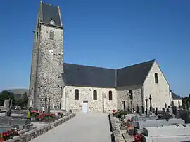 The church of Saint-Hermeland | |
Location of Sottevast | |
 Sottevast 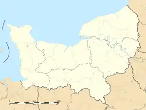 Sottevast | |
| Coordinates: 49°31′25″N 1°35′35″W / 49.5236°N 1.5931°W | |
| Country | France |
| Region | Normandy |
| Department | Manche |
| Arrondissement | Cherbourg |
| Canton | Bricquebec-en-Cotentin |
| Intercommunality | CA Cotentin |
| Government | |
| • Mayor (2020–2026) | Jean-Pierre Tollemer[1] |
| Area 1 | 10.82 km2 (4.18 sq mi) |
| Population | 1,447 |
| • Density | 130/km2 (350/sq mi) |
| Time zone | UTC+01:00 (CET) |
| • Summer (DST) | UTC+02:00 (CEST) |
| INSEE/Postal code | 50579 /50260 |
| 1 French Land Register data, which excludes lakes, ponds, glaciers > 1 km2 (0.386 sq mi or 247 acres) and river estuaries. | |
Sottevast (French pronunciation: [sɔtva]) is a commune in Normandy in north-western France.
| Sottevast | |
|---|---|
| Part of Nazi Germany | |
| France | |
| Coordinates | 49°33′0.54″N 1°35′35.15″W / 49.5501500°N 1.5930972°W |
| Type | bunker |
| Site history | |
| In use | captured before being used |
| Battles/wars | Operation Crossbow |
Sottevast in World War II
During World War II, there was a German storage and servicing bunker for V-weapons near Sottevast.[3] The site was captured by the 504th Parachute Infantry Regiment of the 82nd Airborne Division during the Normandy campaign.
References
- ↑ "Répertoire national des élus: les maires". data.gouv.fr, Plateforme ouverte des données publiques françaises (in French). 2 December 2020.
- ↑ "Populations légales 2021". The National Institute of Statistics and Economic Studies. 28 December 2023.
- ↑ "Sottevast V2 Facility". www.atlantikwall.org.uk. Hand Maid Tours. Retrieved 25 January 2017.
Wikimedia Commons has media related to Sottevast.
This article is issued from Wikipedia. The text is licensed under Creative Commons - Attribution - Sharealike. Additional terms may apply for the media files.