Saint-André-de-Bohon | |
|---|---|
 The detached church bell tower | |
Location of Saint-André-de-Bohon | |
 Saint-André-de-Bohon 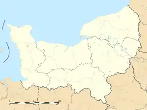 Saint-André-de-Bohon | |
| Coordinates: 49°14′07″N 1°15′03″W / 49.2353°N 1.2508°W | |
| Country | France |
| Region | Normandy |
| Department | Manche |
| Arrondissement | Saint-Lô |
| Canton | Carentan-les-Marais |
| Government | |
| • Mayor (2020–2026) | Hugues Autard de Bragard[1] |
| Area 1 | 10.43 km2 (4.03 sq mi) |
| Population | 366 |
| • Density | 35/km2 (91/sq mi) |
| Time zone | UTC+01:00 (CET) |
| • Summer (DST) | UTC+02:00 (CEST) |
| INSEE/Postal code | 50445 /50500 |
| Elevation | 0–21 m (0–69 ft) (avg. 21 m or 69 ft) |
| 1 French Land Register data, which excludes lakes, ponds, glaciers > 1 km2 (0.386 sq mi or 247 acres) and river estuaries. | |
Saint-André-de-Bohon (French pronunciation: [sɛ̃.t‿ɑ̃dʁe də bɔ.ɔ̃]) is a commune in the Manche department in Normandy in north-western France.[3]
See also
References
- ↑ "Répertoire national des élus: les maires" (in French). data.gouv.fr, Plateforme ouverte des données publiques françaises. 13 September 2022.
- ↑ "Populations légales 2021". The National Institute of Statistics and Economic Studies. 28 December 2023.
- ↑ INSEE commune file
Wikimedia Commons has media related to Saint-André-de-Bohon.
This article is issued from Wikipedia. The text is licensed under Creative Commons - Attribution - Sharealike. Additional terms may apply for the media files.