53°37′0″N 56°34′0″E / 53.61667°N 56.56667°E
Ziganovka
Зигановка | |
|---|---|
Village | |
 Ziganovka  Ziganovka | |
| Coordinates: 53°37′N 56°34′E / 53.617°N 56.567°E[1] | |
| Country | Russia |
| Region | Bashkortostan |
| District | Ishimbaysky District |
| Time zone | UTC+5:00 |
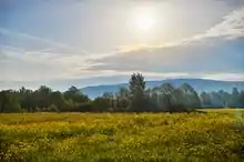
A meadow near Ziganovka
Ziganovka (Russian: Зигановка; Bashkir: Егән, Yegän) is a rural locality (a selo) in Makarovsky Selsoviet of Ishimbaysky District of the Republic of Bashkortostan, Russia,[2] located near the Zigan River.
References
- ↑ Карта Ишимбайского района Башкортостана
- ↑ Правительство Республики Башкортостан. Постановление №391 от 29 декабря 2006 г. «Об утверждении реестра административно-территориальных единиц и населённых пунктов Республики Башкортостан», в ред. Постановления №61 от 26 февраля 2013 г. «О внесении изменений в реестр административно-территориальных единиц и населённых пунктов Республики Башкортостан». Опубликован: "Ведомости Государственного Собрания – Курултая, Президента и Правительства Республики Башкортостан", №5 (251), ст. 239, 12 марта 2007 г. (Government of the Republic of Bashkortostan. Resolution #391 of December 29, 2006 On Adoption of the Registry of the Administrative-Territorial Entities and Inhabited Localities of the Republic of Bashkortostan, as amended by the Resolution #61 of February 26, 2013 On Amending the Registry of the Administrative-Territorial Entities and Inhabited Localities of the Republic of Bashkortostan. ).
This article is issued from Wikipedia. The text is licensed under Creative Commons - Attribution - Sharealike. Additional terms may apply for the media files.