Pocinovice | |
|---|---|
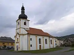 Church of Saint Anne | |
 Flag  Coat of arms | |
 Pocinovice Location in the Czech Republic | |
| Coordinates: 49°20′37″N 13°8′0″E / 49.34361°N 13.13333°E | |
| Country | |
| Region | Plzeň |
| District | Domažlice |
| First mentioned | 1325 |
| Area | |
| • Total | 24.61 km2 (9.50 sq mi) |
| Elevation | 448 m (1,470 ft) |
| Population (2023-01-01)[1] | |
| • Total | 591 |
| • Density | 24/km2 (62/sq mi) |
| Time zone | UTC+1 (CET) |
| • Summer (DST) | UTC+2 (CEST) |
| Postal codes | 345 06, 345 09 |
| Website | www |
Pocinovice (German: Putzeried) is a municipality and village in Domažlice District in the Plzeň Region of the Czech Republic. It has about 600 inhabitants.
Pocinovice lies approximately 19 kilometres (12 mi) south-east of Domažlice, 50 km (31 mi) south of Plzeň, and 126 km (78 mi) south-west of Prague.
Administrative parts
The village of Orlovice is an administrative part of Pocinovice.
References
Wikimedia Commons has media related to Pocinovice.
This article is issued from Wikipedia. The text is licensed under Creative Commons - Attribution - Sharealike. Additional terms may apply for the media files.