
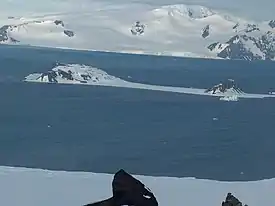

Nevlya Peak (Bulgarian: връх Невля, romanized: vrah Nevlya, IPA: [ˈvrɤx ˈnɛvʎɐ]) is an ice-covered peak rising to 390 m in Breznik Heights on Greenwich Island in the South Shetland Islands, Antarctica. Situated 620 m west of Terter Peak, 1.64 km north-northwest of the summit of Ephraim Bluff, 1.15 km east-southeast of the summit of Oborishte Ridge and 1.35 km east of Salash Nunatak.[1] Overlooking Wulfila Glacier to the west and south.
The peak is named after the settlement of Dolna (Lower) Nevlya in western Bulgaria.[1]
Location
Nevlya Peak is located at 62°32′18″S 59°43′47″W / 62.53833°S 59.72972°W. Bulgarian topographic survey Tangra 2004/05 and mapping in 2009.
Map
L.L. Ivanov. Antarctica: Livingston Island and Greenwich, Robert, Snow and Smith Islands. Scale 1:120000 topographic map. Troyan: Manfred Wörner Foundation, 2009. ISBN 978-954-92032-6-4
Notes
References
- Nevlya Peak. SCAR Composite Gazetteer of Antarctica.
- Bulgarian Antarctic Gazetteer. Antarctic Place-names Commission. (details in Bulgarian, basic data in English)
External links
- Nevlya Peak. Adjusted Copernix satellite image
This article includes information from the Antarctic Place-names Commission of Bulgaria which is used with permission.