Hohendubrau
Wysoka Dubrawa | |
|---|---|
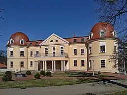 Elementary school | |
Location of Hohendubrau within Görlitz district 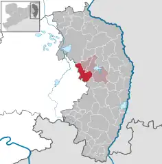 | |
 Hohendubrau 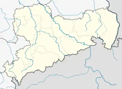 Hohendubrau | |
| Coordinates: 51°14′40″N 14°40′17″E / 51.24444°N 14.67139°E | |
| Country | Germany |
| State | Saxony |
| District | Görlitz |
| Municipal assoc. | Diehsa |
| Government | |
| • Mayor (2022–29) | Henrik Biehle[1] (CDU) |
| Area | |
| • Total | 45.42 km2 (17.54 sq mi) |
| Elevation | 132 m (433 ft) |
| Population (2021-12-31)[2] | |
| • Total | 1,852 |
| • Density | 41/km2 (110/sq mi) |
| Time zone | UTC+01:00 (CET) |
| • Summer (DST) | UTC+02:00 (CEST) |
| Postal codes | 02906 |
| Dialling codes | 035876, 035932 |
| Vehicle registration | GR, LÖB, NOL, NY, WSW, ZI |

Hohendubrau-Dauban. Oberlausitz map, Schenk, 1759.
Hohendubrau (Upper Sorbian: Wysoka Dubrawa, pronounced [ˈwɨsɔka ˈdubʁawa]) is a municipality in the district Görlitz, Saxony, Germany.
The larger part of the municipality belongs to the recognized Sorbian settlement area in Saxony. Upper Sorbian has an official status next to German, all villages bear names in both languages.
References
- ↑ Gewählte Bürgermeisterinnen und Bürgermeister im Freistaat Sachsen, Stand: 17. Juli 2022, Statistisches Landesamt des Freistaates Sachsen.
- ↑ "Bevölkerung des Freistaates Sachsen nach Gemeinden am 31. Dezember 2021" (XLS) (in German). Statistisches Landesamt des Freistaates Sachsen. 2022.
This article is issued from Wikipedia. The text is licensed under Creative Commons - Attribution - Sharealike. Additional terms may apply for the media files.