Habère-Poche | |
|---|---|
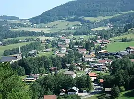 A view of Habère-Poche | |
.svg.png.webp) Coat of arms | |
Location of Habère-Poche | |
 Habère-Poche  Habère-Poche | |
| Coordinates: 46°14′59″N 6°28′24″E / 46.2497°N 6.4733°E | |
| Country | France |
| Region | Auvergne-Rhône-Alpes |
| Department | Haute-Savoie |
| Arrondissement | Thonon-les-Bains |
| Canton | Sciez |
| Intercommunality | Vallée Verte |
| Government | |
| • Mayor (2020–2026) | Vincent Letondal[1] |
| Area 1 | 11.96 km2 (4.62 sq mi) |
| Population | 1,481 |
| • Density | 120/km2 (320/sq mi) |
| Demonym | Dhabérants |
| Time zone | UTC+01:00 (CET) |
| • Summer (DST) | UTC+02:00 (CEST) |
| INSEE/Postal code | 74140 /74420 |
| Elevation | 850–1,560 m (2,790–5,120 ft) |
| Website | habere-poche |
| 1 French Land Register data, which excludes lakes, ponds, glaciers > 1 km2 (0.386 sq mi or 247 acres) and river estuaries. | |
Habère-Poche (French pronunciation: [abɛʁ pɔʃ]; Arpitan: Âbèro d’Amont) is a commune in the Haute-Savoie department in the Auvergne-Rhône-Alpes region in south-eastern France.
Population
| Year | Pop. | ±% p.a. |
|---|---|---|
| 1968 | 452 | — |
| 1975 | 464 | +0.38% |
| 1982 | 511 | +1.39% |
| 1990 | 662 | +3.29% |
| 1999 | 729 | +1.08% |
| 2007 | 1,193 | +6.35% |
| 2012 | 1,294 | +1.64% |
| 2017 | 1,465 | +2.51% |
| Source: INSEE[3] | ||
See also
References
- ↑ "Répertoire national des élus: les maires". data.gouv.fr, Plateforme ouverte des données publiques françaises (in French). 9 August 2021.
- ↑ "Populations légales 2021". The National Institute of Statistics and Economic Studies. 28 December 2023.
- ↑ Population en historique depuis 1968, INSEE
Wikimedia Commons has media related to Habère-Poche.
This article is issued from Wikipedia. The text is licensed under Creative Commons - Attribution - Sharealike. Additional terms may apply for the media files.