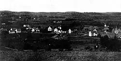
Panoramic view of Glassville, ca. 1910 - 1912
Glassville
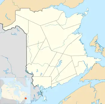
Location of Glassvile in New Brunswick
46°28′59″N 67°25′01″W / 46.483°N 67.417°W
Glassville is a community in the Canadian province of New Brunswick located mainly at the intersection of Route 107 and Route 580.[1][2] It is situated in Aberdeen, a parish of Carleton County.[3]
History
The community takes its name from Charles Gordon Glass, a minister who led his Scottish followers to the area in 1861.[3]
See also
References
- ↑ "Glassville". Geographical Names Data Base. Natural Resources Canada. Retrieved 10 July 2015.
- ↑ Glassville, NB, Canada (Map). Google Maps. Retrieved 10 July 2015.
- 1 2 "Glassville". Provincial Archives of New Brunswick. Retrieved 10 July 2015.
This article is issued from Wikipedia. The text is licensed under Creative Commons - Attribution - Sharealike. Additional terms may apply for the media files.