Flaugnac | |
|---|---|
Part of Saint-Paul-Flaugnac | |
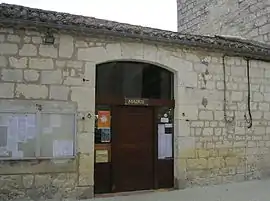 The town hall in Flaugnac | |
Location of Flaugnac | |
 Flaugnac  Flaugnac | |
| Coordinates: 44°16′44″N 1°23′40″E / 44.2789°N 1.3944°E | |
| Country | France |
| Region | Occitania |
| Department | Lot |
| Arrondissement | Cahors |
| Canton | Marches du Sud-Quercy |
| Commune | Saint-Paul-Flaugnac |
| Area 1 | 30.96 km2 (11.95 sq mi) |
| Population (2019)[1] | 410 |
| • Density | 13/km2 (34/sq mi) |
| Time zone | UTC+01:00 (CET) |
| • Summer (DST) | UTC+02:00 (CEST) |
| Postal code | 46170 |
| Elevation | 143–299 m (469–981 ft) (avg. 244 m or 801 ft) |
| 1 French Land Register data, which excludes lakes, ponds, glaciers > 1 km2 (0.386 sq mi or 247 acres) and river estuaries. | |
Flaugnac (French pronunciation: [floɲak]; Languedocien: Flaunhac) is a former commune in the Lot department in south-western France. On 1 January 2016, it was merged into the new commune of Saint-Paul-Flaugnac.[2]
Geography
The Barguelonne forms most of the commune's northwestern border.
See also
Wikimedia Commons has media related to Flaugnac.
References
This article is issued from Wikipedia. The text is licensed under Creative Commons - Attribution - Sharealike. Additional terms may apply for the media files.