Dírná | |
|---|---|
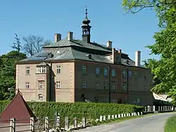 Dírná Castle | |
 Flag  Coat of arms | |
 Dírná Location in the Czech Republic | |
| Coordinates: 49°14′35″N 14°50′41″E / 49.24306°N 14.84472°E | |
| Country | |
| Region | South Bohemian |
| District | Tábor |
| First mentioned | 1340 |
| Area | |
| • Total | 21.98 km2 (8.49 sq mi) |
| Elevation | 469 m (1,539 ft) |
| Population (2023-01-01)[1] | |
| • Total | 425 |
| • Density | 19/km2 (50/sq mi) |
| Time zone | UTC+1 (CET) |
| • Summer (DST) | UTC+2 (CEST) |
| Postal codes | 391 27, 392 01 |
| Website | www |
Dírná is a municipality and village in Tábor District in the South Bohemian Region of the Czech Republic. It has about 400 inhabitants.
Dírná lies approximately 24 kilometres (15 mi) south-east of Tábor, 41 km (25 mi) north-east of České Budějovice, and 99 km (62 mi) south of Prague.
Administrative parts
Villages of Lžín, Nová Ves, Záříčí and Závsí are administrative parts of Dírná.
References
External links
Wikimedia Commons has media related to Dírná.
This article is issued from Wikipedia. The text is licensed under Creative Commons - Attribution - Sharealike. Additional terms may apply for the media files.