Chamchal
چمچال | |
|---|---|
village | |
 Chamchal | |
| Coordinates: 36°48′37″N 50°01′18″E / 36.81028°N 50.02167°E | |
| Country | |
| Province | Gilan |
| County | Siahkal |
| Bakhsh | Deylaman |
| Rural District | Pir Kuh |
| Population (2006) | |
| • Total | 196 |
| Time zone | UTC+3:30 (IRST) |
| • Summer (DST) | UTC+4:30 (IRDT) |
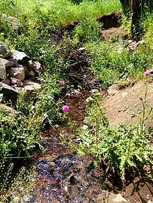
the main water spring of the village

road of village
Chamchal (Persian: چمچال, also Romanized as Chamchāl)[1] is a village in Pir Kuh Rural District, Deylaman District, Siahkal County, Gilan Province, Iran. At the 2006 census, its population was 196, in 44 families.[2]
References
- ↑ Chamchal can be found at GEOnet Names Server, at this link, by opening the Advanced Search box, entering "-3838507" in the "Unique Feature Id" form, and clicking on "Search Database".
- ↑ "Census of the Islamic Republic of Iran, 1385 (2006)" (Excel). Statistical Center of Iran. Archived from the original on 2011-09-20.
This article is issued from Wikipedia. The text is licensed under Creative Commons - Attribution - Sharealike. Additional terms may apply for the media files.