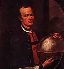
Peter Anich by Philipp Haller, 1759.

Anich's last work, Innsbruck, 1766.
Peter Anich (1723–1766) was an Austrian cartographer and maker of mathematical instruments.[1]
His works, particularly the 1772,[1] published Atlas Tyrolensis, are among the most accurate maps of their time.
References
Wikimedia Commons has media related to Peter Anich.
- 1 2 "Anich, Peter" in Chambers's Encyclopædia. London: George Newnes, 1961, Vol. 1, p. 431.
This article is issued from Wikipedia. The text is licensed under Creative Commons - Attribution - Sharealike. Additional terms may apply for the media files.